Geology
Mt. Teide and the Caldera
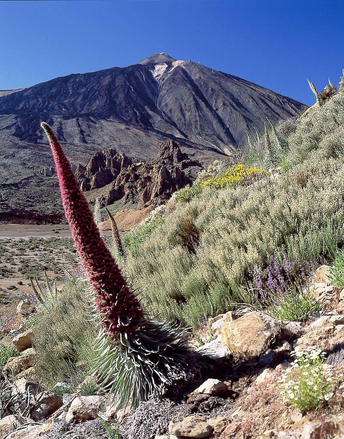
With an altitude of 3,718 metres above sea level, Mt. Teide is the highest mountain in Spain and in all of the Atlantic archipelagos. The steep slopes of the mountain reach this altitude in a mere thirteen kilometres from the coastline. This is a strato-volcano type edifice sitting on an ancient and gigantic cauldron-shaped depression made up of two semi-calderas separated by the Roques de Garcia. Mt. Teide is crowned by the Pilon de Azucar (Sugar Loaf), which is still residually active in the form of fumaroles of steam and sulphur at 86º C.
The Caldera, known as Las Cañadas, takes its name from the most typical feature of the park, the Cañada, a sedimentary plain that is normally situated at the foot of the walls or amphitheatre of the caldera. This entire spectacular geological landscape is derived from a grand volcanic structure, called the Cañadas Edifice, which originally encompassed the central sector of Tenerife. This edifice, with its enormously complex structure, grew in height over the millennia due to the accumulation of large quantities lava flows and layers of pyroclasts, spewed out in many successive eruptions that occurred over a period of 3.5 million years, with alternating periods of construction and destruction. The composition of the material expelled in these eruptions varies enormously: basalts, basanite, trachy-basalt, phonolites, trachytes, etc.
There are two key geological events concerning the Cañadas Edifice and the depression or caldera. On the one hand, the disappearance of the highest part of the Edifice, the internal structure of which is exposed on the wall of the Circus, and the consequent formation of the aforesaid depression. On the other hand, the existence of the Teide-Pico Viejo volcanic complex, a strato-volcano that developed inside the caldera, which later partially filled in this depression.
The landslip hypothesis
The Las Cañadas Circus still arouses controversy among geologists as there are several hypotheses about how it was formed, such as an explosion, erosion, collapse and major land slips.
The most widely accepted theory until the early nineties was the hypothesis of a collapse as the fundamental cause, which assumes that this is a caldera with two sub-calderas; an eastern one and a western one, separated by the Roques de Garcia and formed by subsidence and collapses. The current impressive edifice of the Teide – Pico Viejo strato-volcano was later formed in the northern part of the Las Cañadas caldera. This strato-volcano and the caldera are now the two largest features of the National Park..
Research of the island sub-soil, however, and studies of the sea bed and its relief, in the final years of the 20th century, have confirmed the hypothesis maintained by Tenerife geologist and geographer Telesforo Bravo since 1962, against the general opinion of the scientific community of the time; i.e. that both Las Cañadas del Teide and the Orotava and Güimar Valleys are depressions formed by massive gravitational landslides, of over 100 cubic Km of earth, of a part of the island. The tests that have been done date these episodes at 0.8 million years ago for the Güimar Valley, about 0.5 million years ago for the Orotava Valley and 0.17 million years ago for Las Cañadas.
The partial destruction of the Cañadas Edifice, therefore, was due to a sudden process of gravitational slip of a large part of the former volcanic edifice, sliding down to the north of the island. In this event, which occurred 170,000 years ago, over 100 km3 of the high mountain area of the island disappeared almost instantaneously.
The massive landslide theory was corroborated in 1995, when large deposits of submarine material or deposits of avalanches from the original Cañadas Edifice were discovered on the sea bed to the north of Tenerife. These initial data were provided by the British group of Watts and Mason. The Spanish Teide Group later confirmed this interpretation of the sea beds of the north of Tenerife in 1997. They also investigated the sea beds of the south, where they also found similar deposits originating from the Güimar Valley that, like the Orotava Valley, has similar origins.
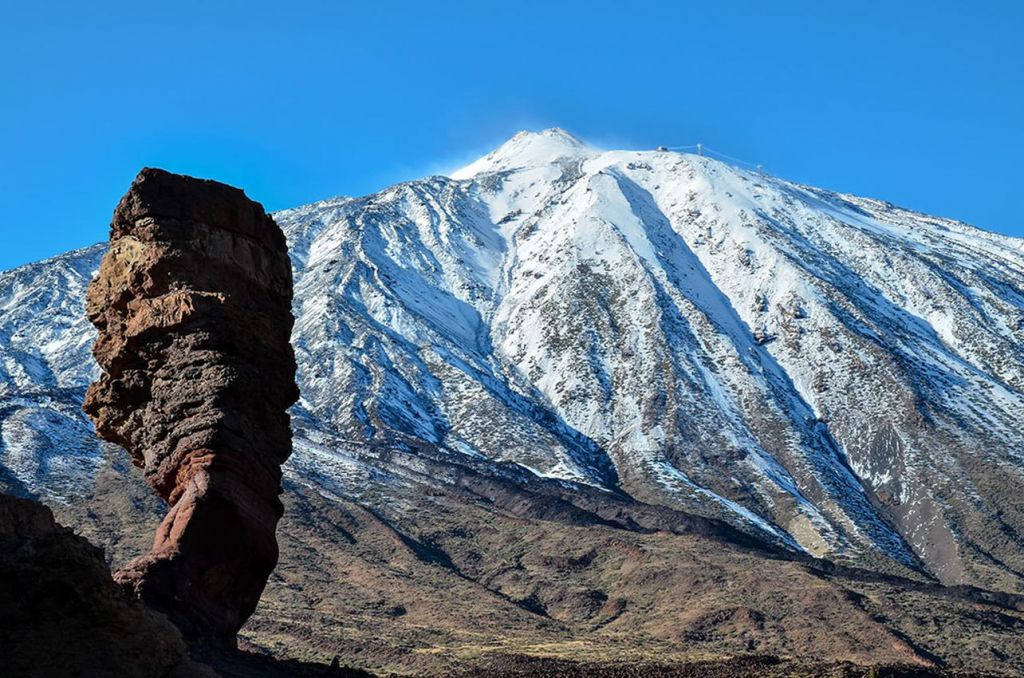
The Roques de García
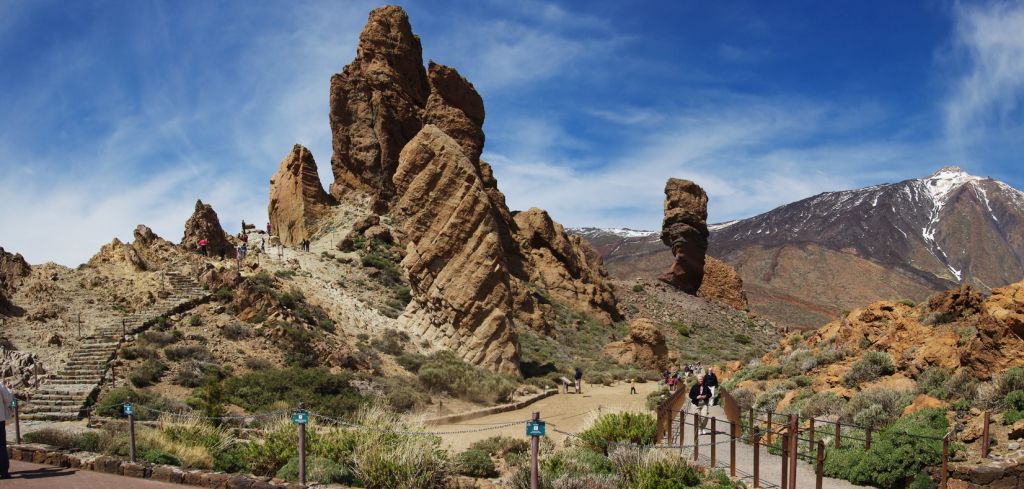
The most striking of the Roques de García is the Cinchado rock. From the look-out spot, one can glimpse the spectacular rock formation and the Ucanca Valley, the largest plain in the National Park. The saw-tooth profile of the Roques is due to the varying resistance to erosion of the materials that make up the rocks: highly resistant dikes and phonolitic towers and rocks that have been eroded by rain and temperature changes that are easily sculpted by the erosive action of water, wind and ice.
Nearby is the National Tourist Parador hotel and another formation, Los Azulejos, with its striking greenish colour due to iron hydrate deposits.
The last recorded eruption that took place within the current boundaries of the national park occurred on the slopes of Pico Viejo, or Chahorra, in 1798, over a period of three months. This was the longest of all the eruptions that have occurred in recorded history in Tenerife: the lava spewed out of a fissure almost one kilometre long covered an area of almost 5 square kilometres and almost spilled over the wall of Las Cañadas through Boca de Tauce, one of the lowest points of the amphitheatre.
Las Cañadas
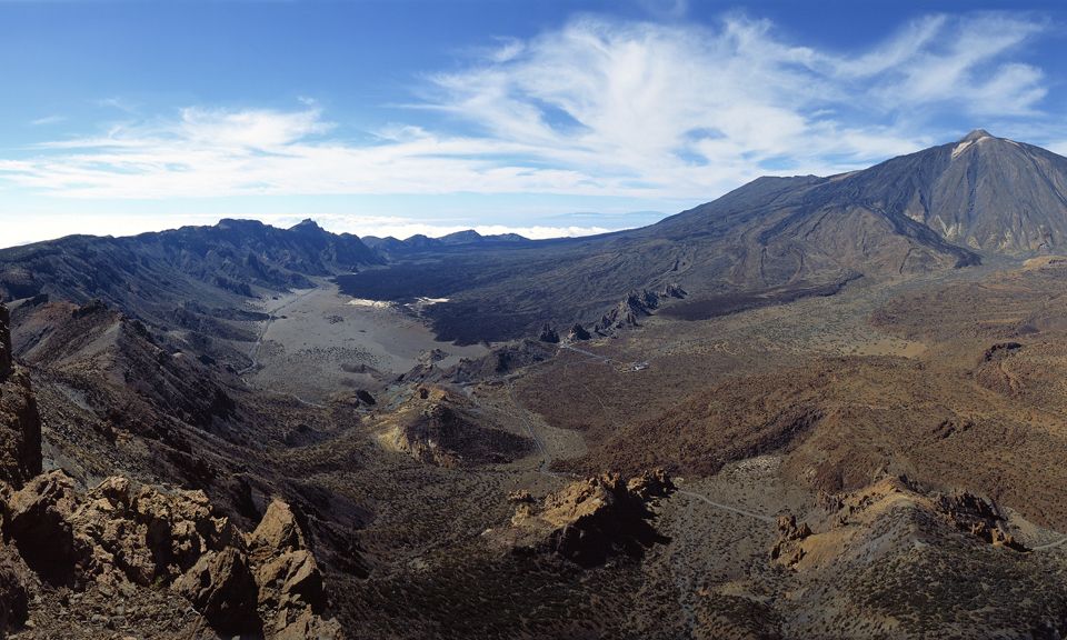
Between the base of the strato-volcano and the foot of the amphitheatre, there is an extensive field of recent lava and pyroclasts, not just from Teide – Pico Viejo, but also from other existing volcanic craters in the zone. The environment is completed by the endorheic plains or flats of sedimentary material all along the base of the wall. These enclaves were called "cañadas" (passes or trails in Spanish) because they were important routes for guiding livestock through a genuine sea of lava, and this name lives on today. This explains the origin of the entire mountain peak area of the island, known in general terms as "Las Cañadas del Teide", or the Mt. Teide Passes.
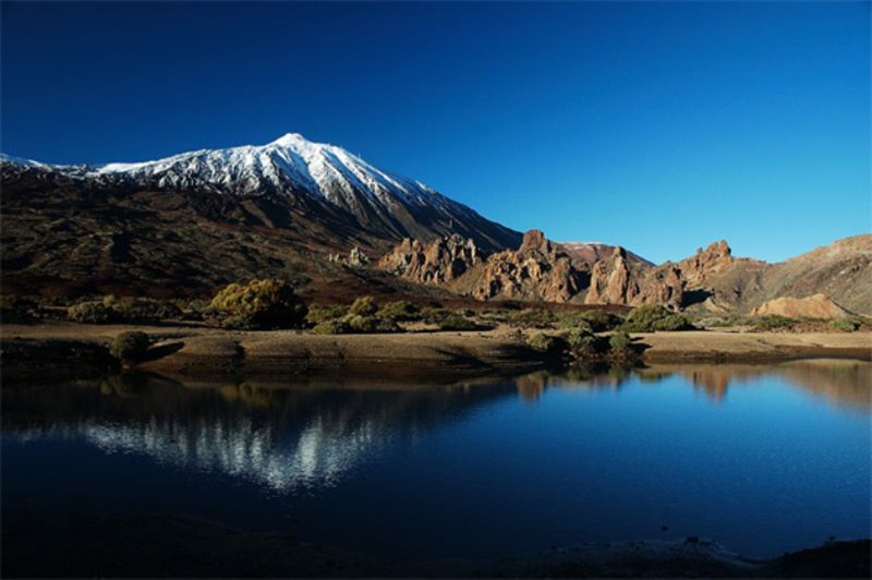
This vast natural cut or amphitheatre reveals the internal structure of the old volcanic edifice (Cañadas Edifice), forged by layers being laid down, one on top of another, recording the history of the eruptions of over a period of 3 million years. Las Cañadas circus is one of the largest calderas in the world. It is elliptical in shape, 16 km across at the widest point, 10 km across at the narrowest and with a perimeter of 45 km, of which, the part that is currently visible covers some 23 km, as the north wall was buried by later eruptions, which have led to the formation of Mt. Teide, whose lavas run down to the base of the cliff, as can be seen in the picture.
The lava from different eruptions has filled in extensive areas of the former caldera with volcanic material of all kinds, sculpting a spectacular landscape of apparent chaos. So, more rounded volcanoes can be seen with yellowish and whitish tones due to the accumulation of pumice stone, like Montaña Blanca, or cones of ash and cinder, ranging in colour from reddish to black, due to the varying processes of oxidation over time, almost perfectly shaped structures like Montaña Mostaza.
The lava flows sometime form slag fields known as "malpaises" or "badlands", others fall down the slopes or run over older volcanoes, forming tongues, and others break up into enormous blocks, such as the "Valle de las Piedras Arrancadas" (Valley of the Broken Stones), near Montaña Rajada, where obsidian, shiny black volcanic glass, abounds. Obsidian was the raw material for the stone industry of the Guanches, who used it to make cutting tools that they called "tabonas".